GNSS RTK Mapping & Drone Photography in Gympie
Your trusted partner for locating, scanning and mapping underground assets, ensuring safe excavation and reduced risk across residential, commercial and industrial sites.
Detailed 2D & 3D Site Models
Licensed & Trade-Qualified
20+ Years of Experience
Serving Diverse Industries
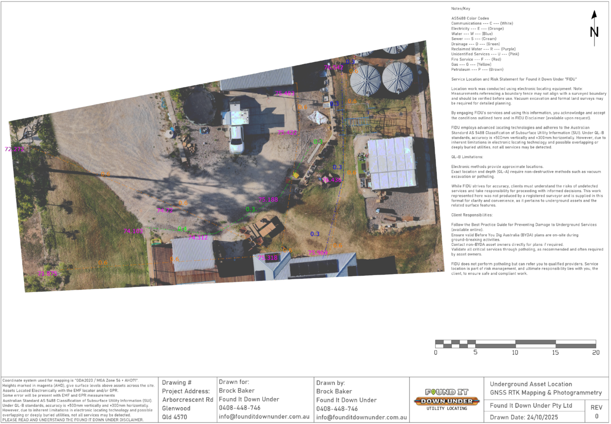
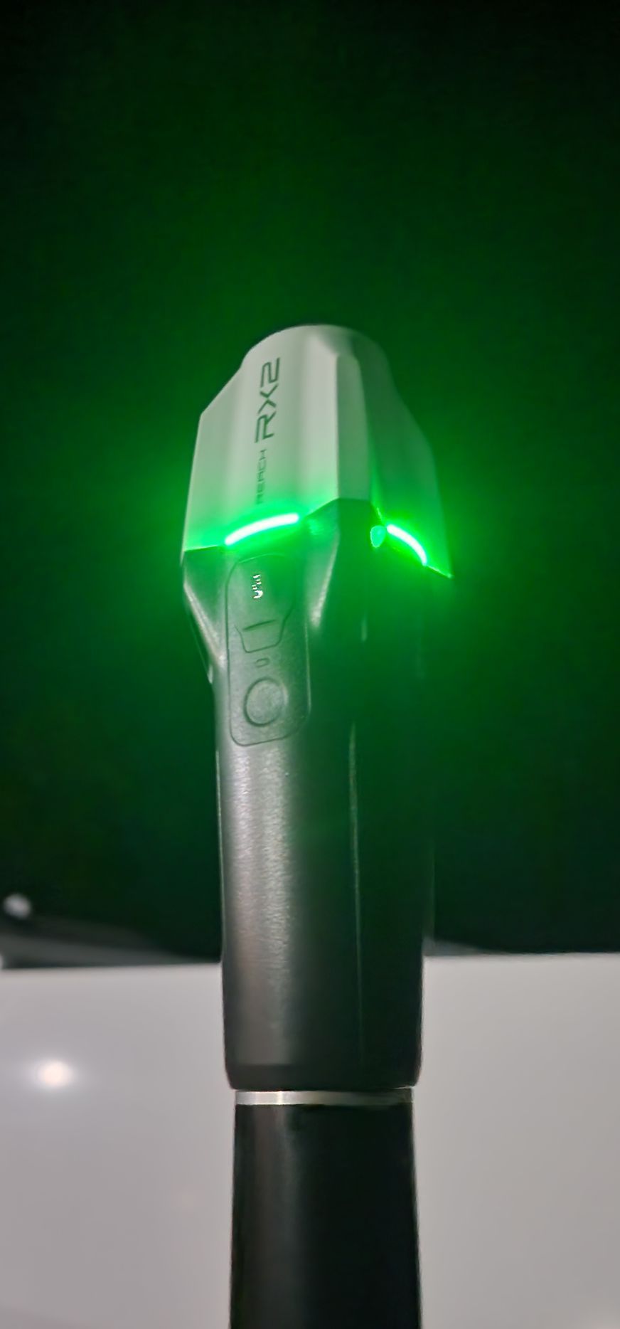
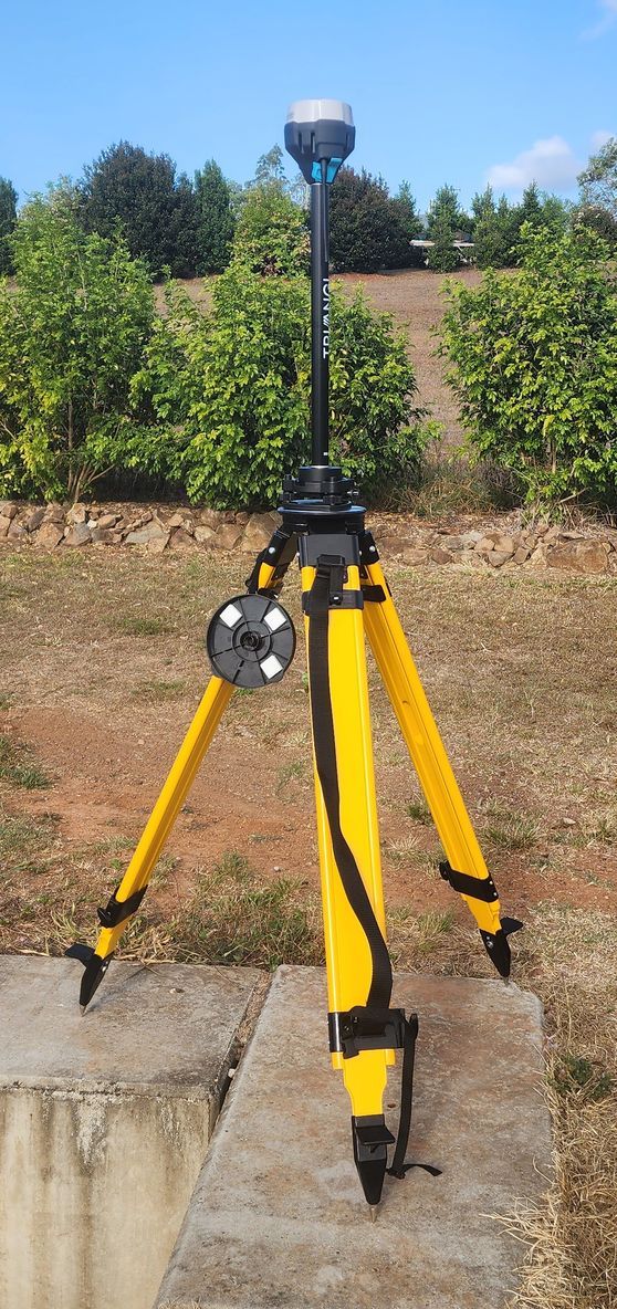
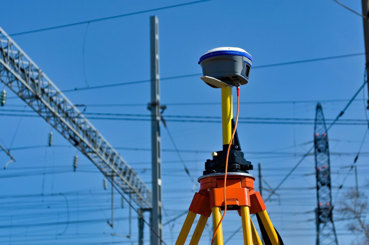
At Found It Down Under, we offer GNSS RTK mapping and drone photography in Gympie and surrounds. Using industry-leading drones and GNSS RTK equipment, we deliver high-quality aerial inspections and mapping services. We offer 2D mapping and 3D modelling with centre-meter level accuracy on data collection, which allows clients to work with builders and engineers for planning and execution of project. At completion, we send out a scaled CAD and PDF files of the project.
This detailed mapping process provides exceptional visibility over landscapes, structures and underground service locations when combined with locating data. It is ideal for construction planning, volume measurement, asset auditing and pre-work design. We also provide utility asset reporting to ensure all captured information is clearly documented.
Contact us on 0408 448 746 to book a mapping assessment or aerial capture.
Contact Us
Contact Us
Thank you for contacting Found It Down Under.
We will get back to you as soon as possible.
Oops, there was an error sending your message.
Please try again later.
Please try again later.
GNSS RTK Mapping & Drone Photography Process
Our GNSS RTK mapping and drone photography process begins with assessing your site and identifying the mapping requirements, whether you need topographic detail, asset positioning, volume measurement or infrastructure planning. Using high precision GNSS RTK equipment and drone photography, we capture site data with centimetre-level accuracy, generating 2D maps and 3D models that reflect true ground conditions. Once captured, the data is processed into scaled CAD and PDF outputs for use by engineers, surveyors and builders. We also supply utility asset reporting to ensure all spatial information is clearly documented for compliance, project planning and future reference.
Book your mapping project with us for precise results.
What Our Customers Say
FAQ
Can GNSS RTK mapping and photography be used together?
Yes, and this is where the value really increases. GNSS RTK provides ground control and positional accuracy, while drone photography builds visual, measurable models over that control. When combined, you receive highly accurate data for engineering, surface modelling and asset verification. Utility asset reporting ties all outputs together for ongoing use.
How long does a mapping job take?
Timeframes vary depending on site size, terrain and complexity. Small residential or commercial lots may be completed within hours, while large industrial or civil projects may require multiple stages of capture and processing. We always aim for efficiency while maintaining accuracy, and utility asset reporting follows promptly after processing is complete.
What deliverables will I receive?
At the completion of each project, clients receive scaled CAD and PDF mapping files, 3D models, orthomosaic imagery and digital elevation outputs where required. We also include utility asset reporting to catalogue findings, coordinates, asset positions and recorded data. You receive everything needed for planning, design and operational decision making.
Backed by
20+
Years of industry experience